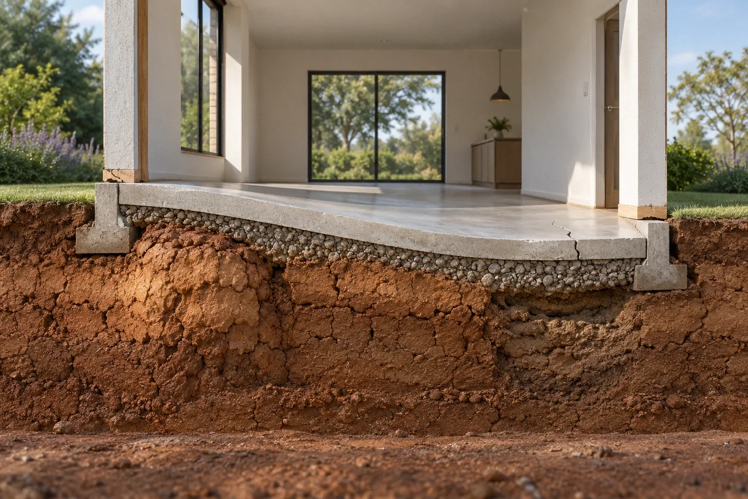
The short answer
Regional land subsidence and settlement beneath one house can occur at different scales and for different reasons. Groundwater-related compaction may lower a broad area, while uneven support beneath a building creates a local structural problem. A map or news report cannot establish which process explains a particular crack. Use regional information to guide questions, then evaluate the house and its immediate ground conditions separately.
US general planning; California details labeled where relevant
Start by asking what the map measures
A subsidence map may show estimated movement over a defined period and area. Before applying it to a house, find its legend, dates, units and stated limitations. A colored area does not necessarily identify the exact movement beneath each footing. It may combine observations across a broader surface or represent an average over the mapped period.
Keep the original map and explanatory notes with any screenshot. A cropped image without its scale is easily misunderstood. Ask whether the data describe vertical movement, a trend or a cumulative difference. The first useful step is understanding the measurement itself, rather than assuming that every building inside a shaded area has the same foundation condition.
How groundwater withdrawal can lower the land
USGS explains that removing groundwater from susceptible aquifer systems can compact fine-grained sediments and lower the land surface in Land Subsidence. This process can occur across a large area and may permanently reduce aquifer storage. The page also identifies other natural and human-related causes of subsidence, so groundwater pumping is not the explanation for every instance of sinking ground.
This regional mechanism differs from identifying a defect in one house footing. The relevant sediments may be well below ordinary residential foundations. An owner therefore needs to avoid translating a regional groundwater concern directly into a familiar repair product. Understanding the scale and mechanism is necessary before discussing what a local foundation intervention could accomplish.
Uniform lowering and differential movement are different
The structural question is often how movement varies across the building and its connections. Relative movement can distort walls, supports and utilities. A broad change in land elevation may also affect drainage or infrastructure without producing the same pattern of building deformation. Neither statement means regional subsidence is harmless; it means consequences need to be evaluated specifically.
The historical HUD guide describes differential settlement and related building observations in Residential Rehabilitation Inspection Guide. Those assessment concepts help separate a general regional concern from evidence of unequal support beneath a structure. A homeowner should record actual cracks, displacement and functional changes, with dates, rather than use the regional map as a substitute for observing the building.
The local soil picture may contain additional issues
A property in a subsiding region may also have expansive soil, disturbed fill, leaking utilities or a slope concern. Those conditions can coexist. It is a mistake to choose the most prominent regional explanation and stop looking for a local one that better matches the evidence.
USDA describes the planning information available from soil surveys in Soil Surveys Can Help You, including texture, slope, water-table conditions and other limitations. Such information can help formulate an investigation, but it does not expose the soil beneath each support. Distinguish the regional data source from the property-specific report. Ask which conditions were sampled, which were inferred and whether the report actually addresses the current building and proposed work.
Compare time periods before linking events
A homeowner may notice a crack this month, while a regional map summarizes several years of observations. That mismatch does not establish that the recent symptom was caused by the mapped process. The crack may have been hidden, the building may have changed, or a local water problem may have developed during a different interval.
Build a timeline that includes available regional records and household observations without forcing them to agree. Add relevant plumbing repairs, excavation, drainage changes and building alterations. If an engineer proposes a causal connection, ask how the dates and spatial pattern support it. A plausible mechanism is important, but it should be tested against the actual evidence rather than simply repeated from a news headline.
A hypothetical comparison within one mapped area
Imagine two homes inside the same regional subsidence zone. One has no documented recent building movement but has begun experiencing poorer street drainage. The other has fresh localized displacement beside a leaking buried line. The regional issue may matter to both owners, yet their immediate questions differ.
The first may need to understand changes in surrounding drainage and infrastructure. The second also needs an investigation of the local leak and support conditions. This hypothetical comparison does not establish either cause or responsibility. It shows why identical map shading cannot produce an identical repair scope. Site observations and the building's response remain necessary even when the broad regional trend is well documented.
Ask what a proposed repair can actually influence
A pier system transfers loads to ground selected for its performance. It does not automatically stop regional aquifer compaction or restore neighborhood drainage elevations. A proposal should explain the intended bearing conditions and how broader ground movement has been considered, if it is relevant.
FHWA's foundation acceptance guide emphasizes site characterization and the connection between ground information and foundation performance in Acceptance Procedures for Structural Foundations of Transportation Structures, GEC 15. Its transportation scope does not prescribe a residential system, but the principle is applicable: the design assumptions need evidence. Ask what the proposed support can control, what it cannot, and how utilities or adjacent structures may respond differently. Avoid accepting a promise that a local repair eliminates every subsidence-related risk.
Match the footprint of the evidence to the claim
A regional map, a neighborhood observation and a measurement beneath one house operate at different scales. Ask which scale a proposed conclusion addresses. A broad area can experience ground lowering while an individual building’s crack is influenced by a separate local condition. Conversely, a localized repair may improve one support without changing the wider ground process shown on a regional map.
Compare the dates as carefully as the geography. A map summarizing an earlier measurement period does not automatically explain a crack first documented years later. Nor does a recent crack prove that the regional process accelerated at that moment. The useful question is whether the available observations overlap sufficiently in location and time to support the proposed connection.
When discussing a repair, request a clear statement of its boundary: which part of the house it is intended to support, which movement mechanism it addresses and which broader conditions remain outside its influence. That does not make the repair pointless. It makes its purpose understandable. Keep regional monitoring information alongside, rather than substituted for, the building-specific assessment. The distinction prevents a dramatic regional map from becoming either an unsupported repair recommendation or an excuse to disregard a repairable local problem.
Keep the regional and household records connected
Retain the map source, date and interpretation alongside the property investigation. If later measurements show building movement, the records will help professionals compare scale and timing. If no movement is established, document that limited finding without turning it into a guarantee about future conditions.
The next action should follow the unresolved issue. It might involve a building assessment, geotechnical input, drainage evaluation or information from local authorities managing regional conditions. A homeowner does not need to become an aquifer scientist to ask useful questions. The essential distinction is between what regional observations show and what has actually been established about the house, its support and its connections to the surrounding site.
Before your next decision
- Save the complete map legend, dates, units and source.
- Separate regional movement from measured changes in the house.
- Document utilities and drainage conditions as well as cracks.
- Ask what ground layer a proposed repair relies on.
- Preserve the limits of each conclusion in the property record.
Related questions
Will piers solve a regional subsidence problem?
Not automatically. Their effectiveness depends on the intended support layer and the movement mechanism. They do not by themselves stop aquifer compaction or correct regional drainage changes.
Does map shading prove my cracks are from subsidence?
No. Map scale, dates and measurement method must be considered, and the building still needs a local assessment.
Can regional subsidence and a plumbing-related support problem coexist?
Yes. Multiple processes may affect the same property. An investigation should compare competing explanations instead of assuming one regional cause explains every symptom.
Sources & further reading
- U.S. Geological SurveyLand Subsidence
Regional land movement mechanisms; not a diagnosis of any particular house.
- USDA Natural Resources Conservation ServiceSoil Surveys Can Help You
Planning-level soils information; not a substitute for parcel-specific subsurface investigation.
- Federal Highway AdministrationAcceptance Procedures for Structural Foundations of Transportation Structures, GEC 15
April 2022 transportation-foundation guide. Transferable concepts only; not residential prescriptive requirements.
- U.S. Department of Housing and Urban Development / National Institute of Building SciencesResidential Rehabilitation Inspection Guide
February 2000 guide; condition-assessment concepts only, not current code or a DIY repair specification.
Homeowner questions behind this article
These discussions informed the questions, not the technical answers. Some were available through indexed excerpts; votes and comments are not an engineering assessment.
- Abrupt transition to irreversible damage in the overdrafted Sacramento Valley aquifer system
- Looking for advice evaluating 35yo hillside foundation
- Foundation company found ~2” floor differential and recommended $30k–$70k in push piers — what would you do?